Trail Distance: 4.4 miles (book), 6.7 miles (MapMyHike)
Elevation Gain: 1,800 ft (book), 1,663 ft (MapMyHike)
Terrain Rating: Intermediate
Time In: 9:31AM
Time Out: 1PM
Conditions: Very icy, drifted snow
Trailhead: The trailhead is at the end of the Welch-Dickey Parking Lot. From 93-N, take Exit 28 and head towards Waterville Valley on Route 49 East. Take a left onto Upper Mad River Road and then a right onto Orris Road. Parking fee is $3.
Hiking the Welch-Dickey Loop
The Welch-Dickey Loop is one of the most popular hikes in the White Mountains. Although it is not one of the 48 4,000 Footers, this hike has everything you could want. Sweeping, open views of the surrounding area, fun granite slab climbs, a good amount of elevation gain, and all at a manageable distance of under 5 miles! The summits of both Mt. Welch and Mt. Dickey offer a vast number of beautiful panoramic views.
It is also one of the closest hikes from Boston. The drive only takes 2 hours!

When to Hike the Welch-Dickey Loop
Summer:
Most people will hike any of the White Mountain hikes in the summer, and especially the Welch-Dickey Loop. You will need to cut across some granite slabs during this hike, and that can get really difficult when it is icy or wet.
The weather will also be a lot more cooperative in the summer – although you may run into more bugs earlier in June.
If you are a beginner hiker or looking for a more relaxed day, I definitely recommend hiking the Welch-Dickey Loop in the summer.
Fall:
Fall is also great here. If you plan fall foliage perfectly, you will be rewarded with gorgeous orange, yellow and red leaves! Hiking here during peak foliage is absolutely stunning and I highly recommend it.
Winter:
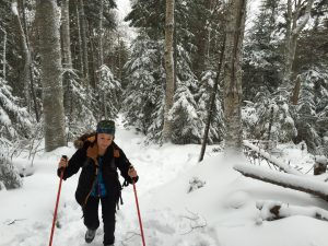
I’ve hiked the Welch-Dickey trail in both winter and summer. For the winter hike, it was personally just more of a challenge for me. I knew the conditions would be a little bit tougher with the granite slabs and I thought it would be fun!
I don’t recommend hiking in the winter if you don’t have the proper gear or if you are just starting out hiking.
Spring:
I personally do not recommend hiking in Spring. Compared to the other seasons, it’s kind of just a drab with the rain and potential mist that will block any views.

Welch-Dickey Hiking Report
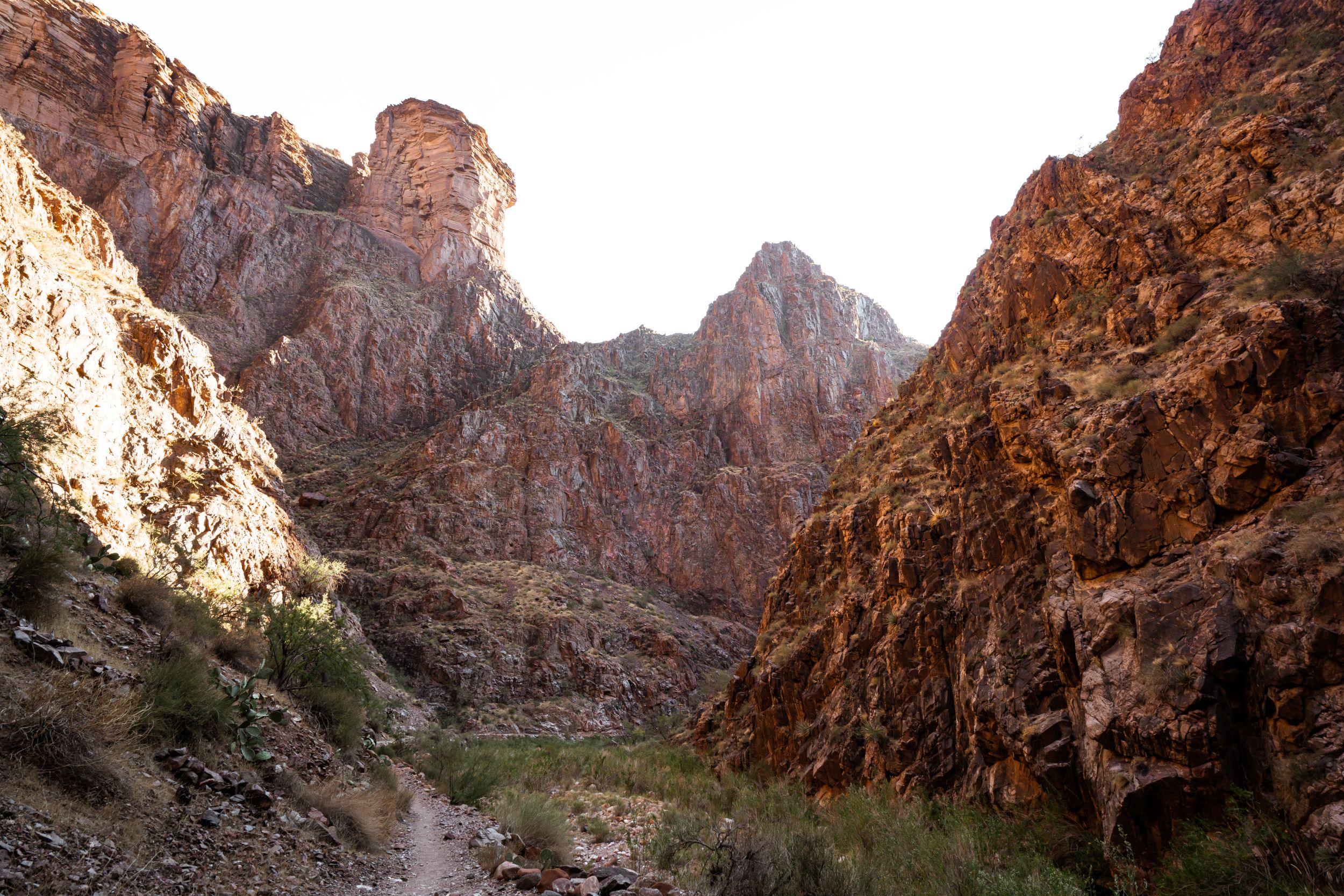
From the trailhead, head right to Welch Mountain to start your counter-clockwise loop. For the first mile, the ascent is extremely gradual. The trail is clearly marked by yellow blazes. There are two small water crossings in the first section of your hike, both very manageable. Soon you will begin your ascent up to the Welch Mountain.
At the next sign with a bright yellow arrow, turn right and follow the logs to the open ledges. This next part is tricky, and we had to search around for a bit before we found where the trail goes off to. The yellow blazes were all covered with ice at this point, so we had to rely on old footprints to find our way around. Walking towards the open ledges, follow the path left until you see a square rock. Before you reach the square rock, turn left and then an immediate right to get to the next sign. From here it is only 0.5 miles to the Mt. Dickey summit. Although it is only a short distance, the connecting trail from Welch to Dickey is full of slippery, icy slabs. Tucker was ok here with minimal help. The slabs were reasonable if you have traction. I needed a hand up a few high rocks, but nothing too bad.
The summit of Mt. Dickey offers 360-degree panoramic views of the area (Franconia Ridge and Franconia Notch). It can also be pretty windy up here. The trail continues to the other end of the mountain. Again, the yellow blazes were covered with ice so we had to pay more attention to navigation. Coming down Mt. Dickey was extremely fun. Aside from a few narrow trails, the descent is full of granite slabs that are open and without obstacles. The quick way down is to slide down, and that’s exactly what we did! Your total descent is 2.1 miles until you reach the parking lot.
All in all it was a great winter hike. We only saw four people today, no other dogs. One couple had a sled with them. Athletic dogs should be just fine for a winter hike at Welch-Dickey. I was surprised when MapMyHike was over 2 miles off from the book trail distance, but who knows how accurate a free app is.
What to Pack for the Welch-Dickey Loop
Hiking Boots / Shoes
Having the right shoes is super important. Whether you like lighter shoes like I do or a sturdier hiking boot, Hoka One One and Salomon are my go-to products. I would say that for this hike, you would want shoes with a really good grip. Hoka One One and hiking boots both have a good grip.
Sun Protection
Sun protection is important for Welch-Dickey year round! Even in the winter, the sun can get brutal on your skin if you don’t wear SPF.
Winter-Specific Gear
Food!
Level Foods has been my new go-to bar. I found that their bars have been better on my stomach. They are Gluten free, Dairy free, Non-GMO.
For this hike, I packed 5 granola bars (but only ate 2).
Water Storage
I personally prefer using an MSR Drom Bag because I’m fairly lazy to take water bottles out of my bag, but both options are great. If you use a drom bag in the winter, just beware that the tube could freeze over. For this hike, I packed 2 Liters of water.
More Photos:

Where we got lost after the first yellow arrow. Turn left before the square rock! First set of icy slabs up Mount Welch. View of Mount Welch from the summit of Mount Dickey.