Trail Distance: ~7 miles
Elevation Gain: minimal
Terrain Rating: Above Average
Hike In: 8 AM
Hike Out: 2:05PM
Trailhead: The river begins in the small town of Sanjhan or Pratan. Ask around for the river – it’s quite famous and the locals are extremely friendly.
, Taiwan (台灣) - Golden Grotto Trip Report 1")
Getting to Sanjhan: This was the most difficult part of our trip planning. Information about Sanjhan is sparse. There is a main website with an informative map, but the process itself is a bit different in reality.
- From Taipei, take the rail to Hualien. The TRA website is English-friendly and extremely useful for planning. You can also go to the Taipei Railway Station directly and ask the friendly attendants. If you’re not on a budget, be sure to take the express train. We made a mistake on the way back and sat on a very very slow train. An express ticket is $30, a local ticket is $12.
- Once you get to Hualien, there are many food stands to explore around. You can also take a day to explore Taroko National Park. From there, a taxi is about $20 to Sanjhan. Not all cab drivers will be familiar with the town itself, so be sure to print out a map and the chinese characters for Sanjhan.
Lodging: You can either stay in Hualien, a more populated and vibrant town, and taxi to Sanjhan in the morning, or stay at the Moon Rivers Guest House in Sanjhan. The guest house is simple and includes a free delicious breakfast at a local spot across the street. The best way to book a room there is to call Jessie (use Skype if you don’t know anyone with an international phone). Email communication was slow. We wanted to start early in the morning and decided on staying in Sanjhan.
, Taiwan (台灣) - Golden Grotto Trip Report 2")
In the morning, we woke up to an amazing breakfast of Taiwanese stir fried rice noodles, a homemade hot sauce from the “grandma”, and soy milk. The woman who runs the stand was so excited for us that she even gave us some steamed buns to-go for our journey! Have I mentioned that the locals in Taiwan are the friendliest in the world??
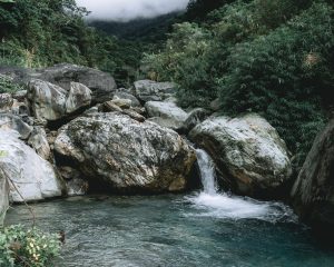
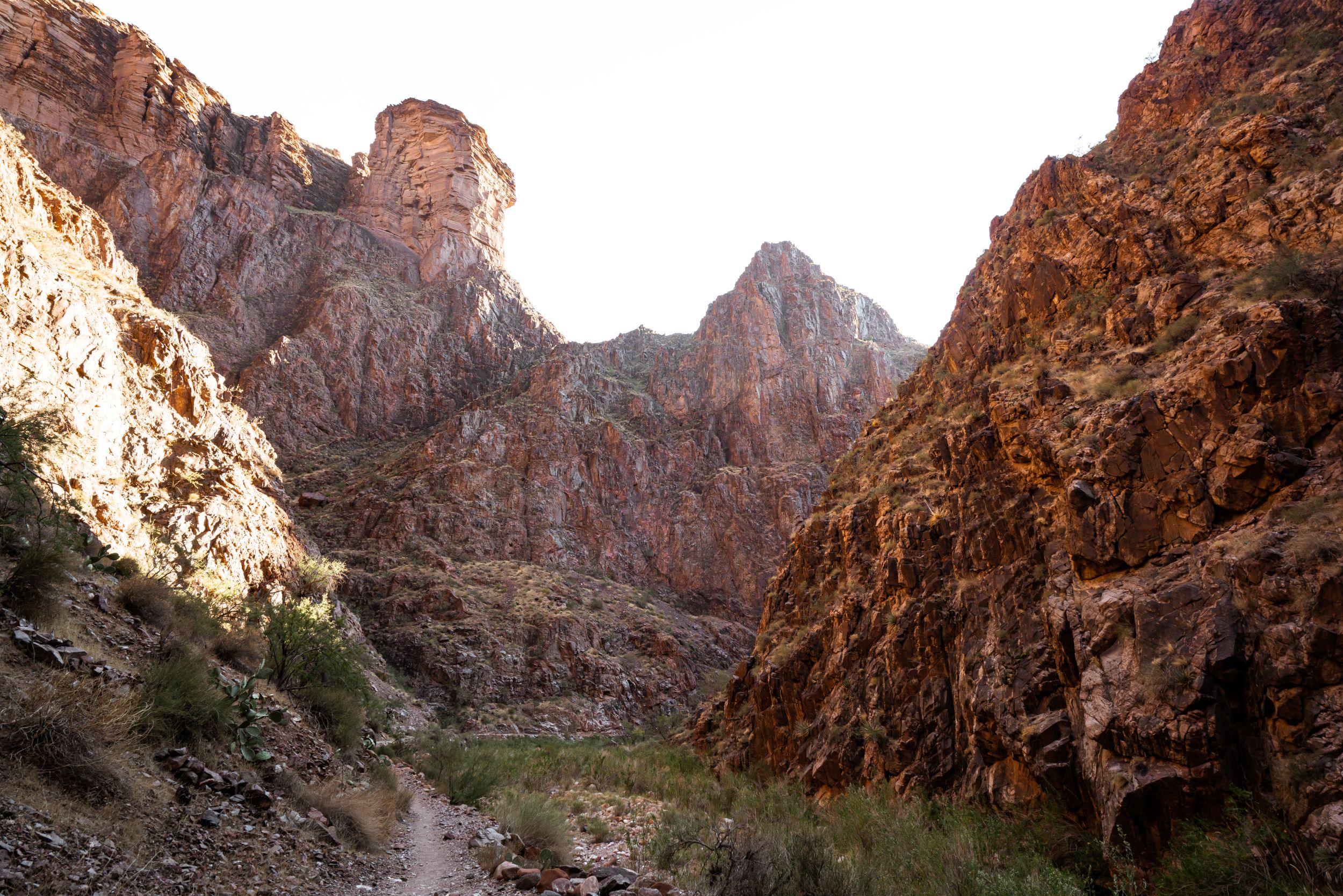
The first 2 miles traces around a foot path/river. It takes some looking ahead to see whether or not you want to be on the path or the river, and whether or not you have to cross the river. In terms of river-tracing excitement, there weren’t too many waterfalls or small cascades to play around. We did these few miles pretty quickly to get to our destination as fast as we can! You will pass an army barricade on your left a little less than a mile in.
After that, the river really opens up and you might have to cross through some waist-deep water, depending on the amount of rain that season. We ran into some photographers here, sitting on a big rock in the middle of the river. They encouraged us that the Golden Grotto was not too much further! The valley narrows in and becomes extremely steep. On your right, you will see the entrance for the Golden Grotto, characterized by giant pools of water and big boulders. We left our packs outside here and brought only a rope and a camera through the pools.
Both Loc Tite and I wore Chacos. I had brought a pair of river trekking boots but didn’t put them on just yet. I got a few rocks stuck in between my Chacos, and some blisters. I would recommend just starting off with the boots. You can buy NRS boots here, or wait until you are in Hualien and go to the outdoor store there. Taiwan specializes in river-trekking, so you can expect to find some specialty equipment in the actual country than in the US.
, Taiwan (台灣) - Golden Grotto Trip Report 3")
looking down after the first climb!
The swim through the first pool is exhilarating. Although it was a misty 60 degree day in Taiwan, the water was pretty warm! We both wore wetsuit tops only, and just quickdry shorts on the bottom. The first climb (~8 ft) is advertised as “easy,” and it might be for men with longer arms who can easily do 10 pull-ups. As a fit female, I didn’t find it to be quite as easy. Imagine trying to get yourself up from a swimming pool, except the distance between the water and the ledge is more than an arm’s length, and there’s a waterfall blocking your vision. There is no rock to stand on here, so it’s all upper body strength to get out of the pool. The first climber should be the stronger of the group. From there, the rest of the group should be able to get up easily with the assistance of climber #1.
, Taiwan (台灣) - Golden Grotto Trip Report 4")
After swimming through another pool, the second climb opens up at around 12 ft. You have to look for hand-holds inside the waterfall and climb up the waterfall. A rope is optional here. There’s an anchor at the top but no rope was there as of April 2014. The stronger climber can go first, and drop a rope down for the rest of the group.
The third climb is around 20 ft. When we went, there was already a rope there. We brought one just in case, because it would suck to get all the way here and not be able to make it up!! Using the rope, pull yourself up until you reach the top. There isn’t too much algae on the rocks here. With a pair of river boots, you should be able to reach the top quite easily. Note that on the way back down, you should climb with the rope facing the wall. I’ve seen people trying to scramble down a slippery rock with their butts to the wall, faces away.
, Taiwan (台灣) - Golden Grotto Trip Report 6")
After the rope climb, the entire space opens up to the beautiful Golden Grotto. Don’t forget to take your Shower of Power!!! From here, the return follows exactly what you just did. We got back in the middle of the afternoon, ready for a nice warm noodle soup snack.
Gear Specs:
- 2L of water
- Standard daypack with drybags inside
- 2 granola bars brought from the US
- Chacos, River Tracing Boots
- ~30 ft of rope
- Quick Dry Shorts and T-Shirt, Rain Jacket
- PackTowl Nano Towel
- BUFF Headband
- Waterproof Camera
- Extra clothes packed away in a drybag: Fleece layer, quick dry shorts, t-shirt
- Emergency gear: Headlamp, reduced First-Aid Kit, Swiss Army Knife
7 Comments
Hello, so did you guys have a guide? If not, was the entrance, after the 1st east bit, easyto find?
Hi Lisa, we did not have a guide. Yes it’s very easy to find! I would keep some sort of distance tracker with you (iPhone app, Fitbit, etc) to help finding the entrance of the waterfall, but it’s an obvious turn off the river.
Hi Melissa,
Your adventure sounds amazing! Did you have to apply a permit to enter the Golden Grotto?
Thanks:)
No permit necessary!! Enjoy it
Hi! I was thinking of doing this with my husband this weekend without a guide but now that you’re describing these 20ft waterfalls I’m getting nervous! Would you suggest to do this without a guide? My husband and I are decently athletic but grad students hah, so not in the best shape of our lives. Did you feel safe enough climbing up and down the waterfalls without a guide and without helmets or anything?
Thank you for the detail of your blog post and all of the information 🙂
Hi Dahlia! If you have never used rope to climb a waterfall, I would suggest a guide! Otherwise it’s relatively straight forward.
Thank you so much for your reply! We are going to try it this week! Love your blog and all your photos! 🙂