
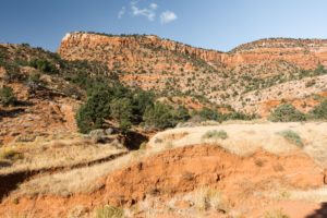
Mount Tam Watershed is the perfect place for a short afternoon hike with your pups! The views are beautiful along the water, and the dogs will love the shade!
Trail Distance: 5.3 miles
Elevation Gain: ~800 ft.
Terrain Rating: Easy – dirt but moderate grade throughout
Hike Time: 2.5 hours
Dog Friendly: Yes but watch out for ticks
Recommended Seasons: All
Trailhead: Bon Tempe Lake Trailhead near Fairfax, CA here
We headed out to Mount Tam Watershed early on a Saturday morning but we were surprised to find the parking lot already full! We waited for a bit before finding a spot to squeeze into. Although the parking lot was full, the trail empties out after a bit because of the vast trail network here. We chose to do the Kent Trail – Stocking Trail – Rocky Ridge Fire Road loop clockwise.
When you get to the trailhead, head across Rock Ridge Fire Road between the two bodies of water and make a right turn to start your loop. The trail goes along Alpine Lake and provides some great views.

From there, it heads into the forest and becomes shaded. When you reach an intersection, make sure you head to Kent Trail which connects to Stocking Trail. The trail will head up some mild elevation for a bit before popping out and giving you beautiful views of the surrounding area.
Overall the hike took us around 2.5 hours. It was really only crowded in the beginning at Rocky Ridge Fire Road and when we got close to the parking lot again. We will definitely return here although warning that we found a lot of ticks on our dogs. Luckily with their tick medicine none of them stuck on and we were able to easily flick them off. We also did a tick check on ourselves and didn’t find anything.


One Comment